Recent Searches
Clear all
Copywriter
Careers
CAREERS
Amity University
Colleges & Schools
COLLEGE
Trending Careers
Geophysicist
12.0LPA.
4.4
User Interface (UI)designer
Human Resource Management
N/A.
Search Categories
Courses & Content
Exams & Tests
Videos
Follow us
GIS/Remote Sensing Specialist
Geographic Information Systems (GIS) and remote s show more
Geographic Information Systems Analyst
GIS analysts use GIS software to compile, analyze show more
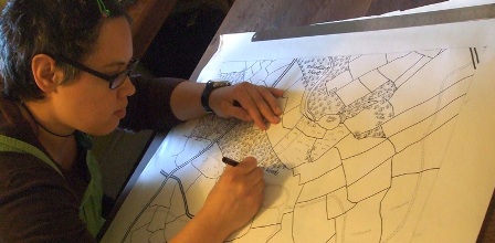
Cartographer
Cartographers are responsible for creating accura show more
Geospatial Intelligence Analyst
Geospatial intelligence analysts analyze and inte show more
Geographer
Geographers study spatial patterns and relationsh show more
Surveyor
Surveyors gather and measure physical data on lan show more
Geospatial Project Manager
Geospatial project managers oversee the planning, show more
Web Mapping Specialist
As maps and spatial data become more accessible o show more
Navigation System Developer
Navigation system developers specialize in creati show more
Academic/Researcher
Many cartography professionals work as professors show more
Every Student, Career Ready!
© 2025 TopTeen. All rights reserved.
Terms & Conditions •Privacy Policy


 4.4
4.4